PROJECTS > Cusick Creek Restoration
Cusick Creek Restoration
Location
North Powder, OR
Total Cost
$450,000
Project Partners
- Oregon Watershed Enhancement Board
- Keating/Baker Valley SWCD
- Landowner
Project Elements
- Historic Channel Reactivation
- Floodplain Reactivation
- Bridge Installation
- Culvert Installation
- Riparian Planting
- Bank Stabilization
RSI Involvement
- Hydraulic and Hydrologic Modeling
- Design
- Permitting
- Construction Oversight
Project Description
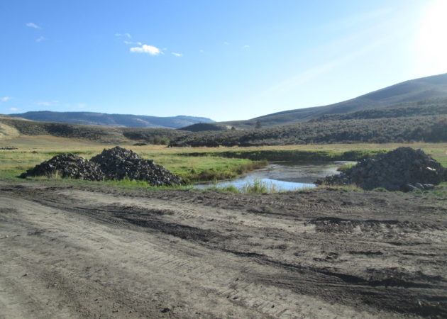
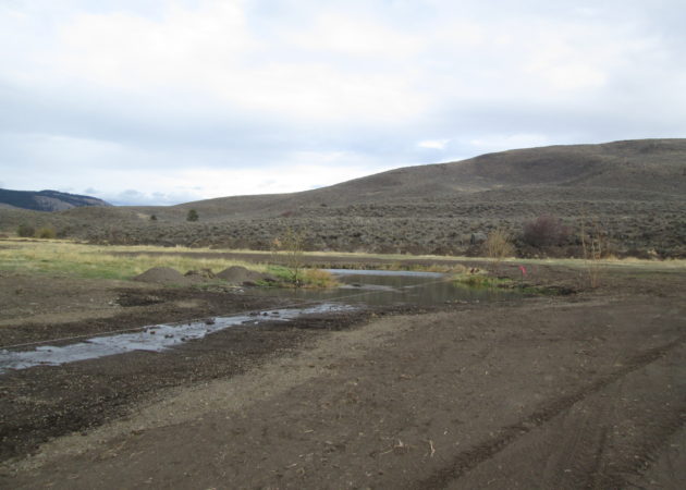
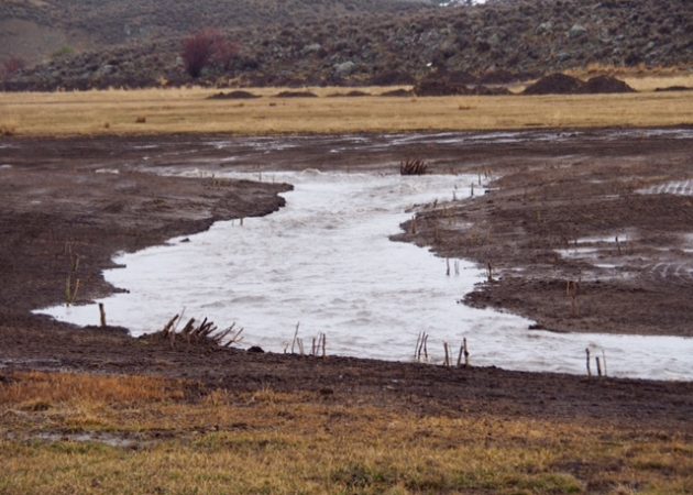
Cusick Creek is a perennial stream that flows into Thief Valley Reservoir, an impoundment on the Powder River in north eastern Oregon. The lower mile of Cusick Creek runs through a relatively broad, low-gradient valley prior to entering the reservoir. A 4,000 ft section of the historic channel had been deactivated with all surface flow of the stream directed down a ditch running along the southern edge of the meadow. The southern channel had very poor habitat and was highly incised with a high degree of active erosion. The northern channel had been transformed into a series of ponds separated by large berms and sustained by hyporheic flow. Thief Valley Reservoir warms significantly during the late summer months and Cusick Creek offers important cold water habitat for the resident fish.
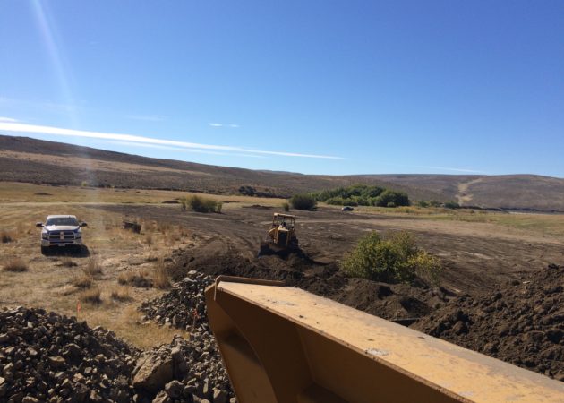
The project purpose was to restore the historic channel of Cusick Creek to provide a stream system that is passable to all life stages of fish, reconnect Cusick Creek to the floodplain, improve riparian conditions, and to provide the landowner with access across the creek. This was accomplished by removing the existing berms in the historic channel and installing armored riffles consisting of an engineered rock matrix along with rootwads and plantings for bank stabilization. A control riffle was designed at the channel split in order to allow a portion of high flows to bypass through the southern channel until vegetation becomes established along the historic channel.
RSI worked closely with the landowner and the Keating/Baker Valley SWCD to insure that the proposed design would satisfy the project goals as well as provide the landowner with an aesthetically pleasing stream/riparian layout.
A planting plan was developed to help revegetate the project area including native riparian species such as aspen, cottonwood, and willows.