PROJECTS > Lower Bridge-Bear Creek Habitat
Lower Bridge-Bear Creek Habitat Water Quality
Location
Mitchell, OR
Total Cost
$722,000
Project Partners
- Oregon Watershed Enh. Board
- Ecotrust
- U. S. Fish and Wildlife Service
- Oregon Dept. of Fish & Wildlife
- Wheeler Soil and Water Conservation District
- Bridge Creek Ranch LLC
- Confederated Tribes of the Warm Springs
Project Elements
- Invasive Species Treatment
- Large Wood Placement
- Floodplain Reactivation
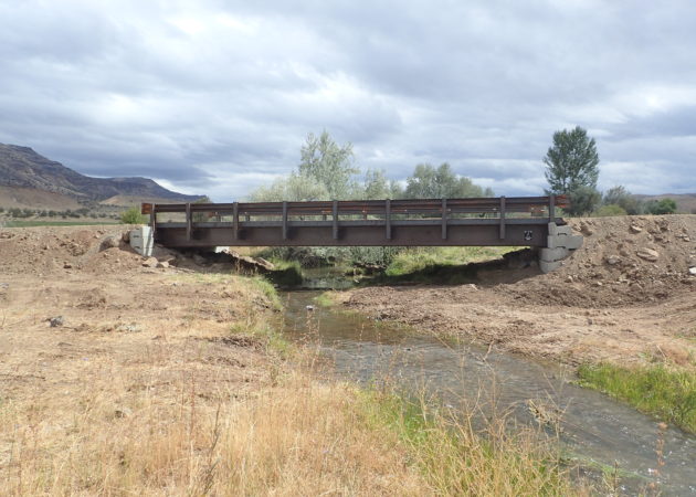
- Bridge Installation
- Riparian Fencing
- Riparian Planting
- Bank Stabilization
RSI Involvement
- Funding Acquisition
- Hydraulic and Hydrologic Modeling
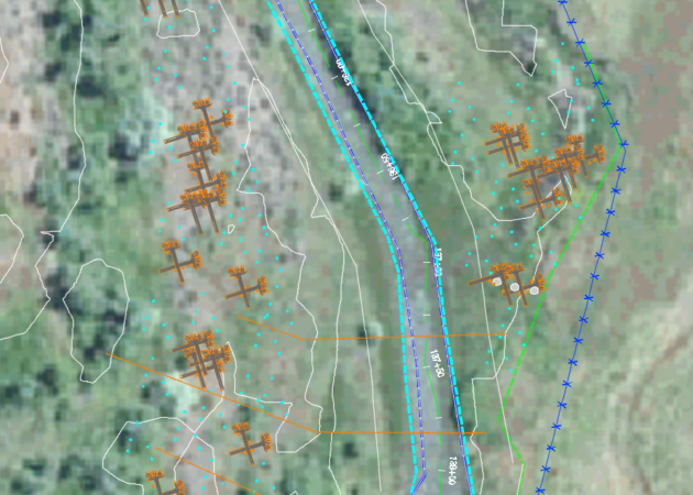
- Instream and Bridge Survey and Design
- Permitting
- Riparian Planting Planning and Implementation
- Partners and Contractors Coordination
- Fencing Layout
Project Description
Bridge Creek is a highly productive tributary to the John Day River that flows next to the Painted Hills National Monument near Mitchell, OR. It is used extensively by steelhead and Chinook salmon for migration, spawning, and rearing.
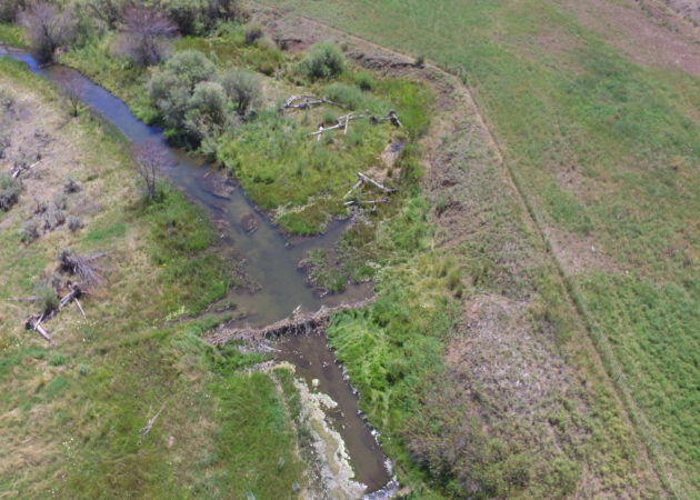
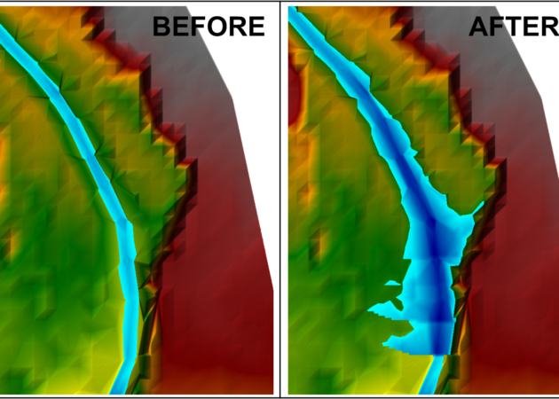
A large amount of restoration work has been completed on public lands upstream and downstream of the project site through NOAA’s Intensively Monitored Watershed (IMW) program. This project focused on a large private inholding consisting of 2.5 miles of Bridge Creek and 0.5 miles of Bear Creek. Stream conditions had been degraded from extensive cattle presence and invasive Russian olive trees had been allowed to proliferate. The stream had become disconnected from the floodplain in most locations and there was a high degree of erosion present with vertical banks in excess of 10 feet in places.
This project was a multi-year endeavor with the end goals of improving floodplain connectivity, reducing invasive species, improving riparian complexity, improving fish habitat, and correcting a high use stream crossing. RSI worked with the Wheeler SWCD, its partners, and the landowner to develop an overall restoration plan for the reaches of concern. In addition to providing engineering services, RSI also worked to develop the Russian olive treatment plan and post project riparian planting plan. Once the restoration plan was developed and accepted by the project partners, RSI assisted the SWCD with grant writing to secure the necessary funding for implementation.
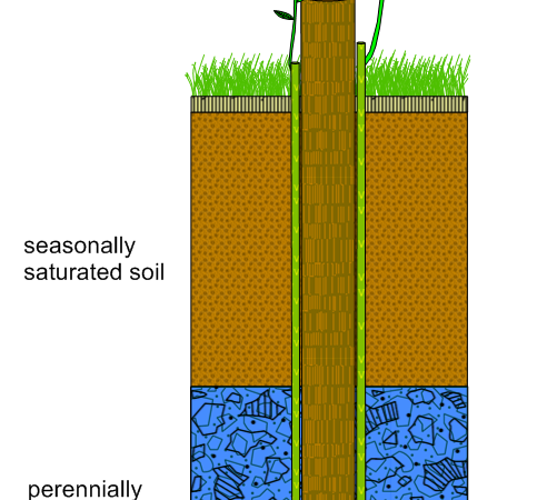
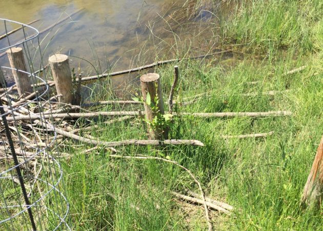
One of the project parameters dictated by the funding sources for the floodplain connectivity was that only low impact bio-engineering methods could be used, which ruled out constructed riffles and channel spanning rock structures. The preferred technique arrived on after method feasibility analysis was to use a combination of large wood structures (LWD) and vertical post structures (VPS). The VPSs had been implemented within the Bridge Creek drainage on BLM lands by NOAA and have proven to be an effective restoration method for the area. RSI utilized this method and modified it to provide an improved version which promoted long-term ecological benefits through the addition of live willow whips which would replace the untreated post with a live tree as the post decayed. The modification included drilling two 1” holes through the post towards the bottom point and inserting 6’ willow whips into the holes. The posts were then driven into the designed alignment using an excavator mounted plate compactor fixed with a retention collar. The method allowed the whips to be pulled into the ground up to 5’ which allowed access to the low flow water table.